Monday 24 December 2012

Saterland

6-12-2012

I doubt few people from England spend their holidays in East Frisia. I had heard the area was noted for its melancholy expanses of peat moor and fen, interspersed with inhabited sandy ridges. As a visitor from East Anglia, I was keen to find out how this landscape related to the fens and heaths back home. There was also an historical dimension: parts of England had been settled by people from this area in the 5th and 6th centuries, so I hoped to encounter some East Frisians, whose language shares a common Ingaevonic root with Old English. I had pored over a few modern Frisian texts, glimpsing common ground with English; I had heard old stories that fishermen from Great Yarmouth in Norfolk and Harlingen in Frisia could understand one another. I had a few spare hours for a journey into this ancestral territory.

5th Century iconography from Gallehus in northern Frisia
http://en.wikipedia.org/wiki/Golden_Horns_of_Gallehus

I caught bus S90 from the Bahnhofplatz at Oldenburg, at 09.42 on a frosty morning. The sun seemed barely out of bed. My destination was the villages of Saterland, home to the last surviving speakers of East Frisian. Its four villages are strung out along a low sandy ridge about 10 miles long bordered by low-lying, peaty land. The journey would take over an hour, and I was not sure what I would see at the end of it, although heaths and moors figured in my imagination. The bus headed westward through a prosperous and well-kept  snowy landscape. There were no signs of wilderness; the landscape exuded an air of ordered employment. My map was rudimentary, but sufficient to track our progress from place to place: Friedrichsfehn, Hengstforde, Roggenmoor, Holtland - names which I could roughly translate into English. My destination was Ramsloh, the biggest village in Saterland.

I missed my stop. The bus had gone a mile beyond the town before I realised and pressed the red button...

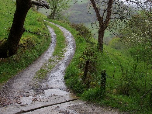
The doors hissed open and I stepped down onto a frozen road. The bus drove away. I found myself suddenly alone in a bleached landscape of bare fields, woods and ditches, with a flock of black birds and a calvary for company. The moors lay somewhere to the east. Luckily, I was standing next to a signpost saying ‘Moors Experience Trail’.
"Wayfaring always overshoots its destinations, since wherever you may be at any particular moment, you are already on your way to somewhere else" (Tim Ingold: 'Being Alive'; Routledge 2011).


There is something numinous about alder trees: their bristly, purplish twigs, their watery habits and uncanny bleeding bark. They lined the road I walked along, and fringed the canal I crossed. Turbid water flowed under the bridge, stained a yallery-brown colour from ochre formed in oxidising peat. The peatlands and fens were evidently not far away, but they could not be seen through surrounding woodland. I came to a fork in the road, but frustratingly the trail sign was pointing back the way I'd come.

Woods, fields, a farm… after half a mile I began to sense I had taken a moorless road, and the map offered no clues to the local geography. Cold was clamped on the land. An enormous field a mile wide lay before me, and in the distance was the foggy shape of a village with a church spire. I decided to ask directions at a lone cottage, where a blue car had just driven up. A fair-haired young woman was handing over a packet to a short, bearded man at the gate. “I am lost; can you tell me where I am on this map, please”, I asked her in my best German. She laughed and said she spoke a little English. The two of them inspected the map, but could make no sense of it. He gesticulated and said the distant village was Scharrel. He spoke with a thick accent of some kind; his face was squarish and framed by masses of bristling, rusty brown hair; his manner was guarded. I was just thanking them and turning to go, when the front door opened and an aged man appeared in the doorway. His face was a remarkable sight: long and pale, with wispy hair like cirrus cloud, and eyes of a clear, rain-washed blue. An elaborate ceremonial wreath was leaning against the wall of the house beside him. I wanted to ask many questions, but feared intruding on their world with my anthropologist’s gaze. I guessed they were not used to strangers – particularly tall English ones. I reckoned it was time I was on my way. Thanking them for their assistance – especially the young woman – I turned and began the return journey from this, the Ultima Thule of my Frisian expedition.

The cold was beginning to bite before I had walked far; a fine hail was beginning to fall. Clearly I would have to visit the moors on some future day. Dejection was also beginning to bite. But as luck would have it I saw the blue car approaching, and my translator wound down the window to ask whether I’d like a lift. I needed little prompting to accept her offer; perhaps she could also answer some questions. This was the Feast of St Niklaus, she said, and her job was to deliver presents to old people in the district. (In England, she'd have been wearing red and white fancy dress, I reflected.) The old man and his wife at Firtree Way were celebrating their 50th wedding anniversary; they spoke East Frisian at home. Would I like to visit the tourist office and get more information? She would drop me off there if I liked. When we arrived at the Council offices at Ramsloh, she reached into the back of the car and presented me with a chocolate figurine of St Niklaus - I was delighted.

The tourist office were having a quiet day at home. I was clearly pushing my German to the limits when I asked them about Ostfriesisch culture in Saterland. Luckily the man there spoke some English, and he said that his colleague, Frau Janssen, a striking, dark-haired woman, was a native East Frisian speaker. I asked why I had seen no bilingual street signs in Ramsloh. She explained that the language was dying out;  there were perhaps only 1,300 speakers left, amounting to less than 10% of the local population. Indeed, Saterland had appeared in the Guinness Book of Records, 1990, as the smallest ‘language island’ in Europe. She explained that a Saterland Alliance (the Seelter Bund) was working hard to keep the language alive, and it was taught from Years 1-4 at school. She said the East Frisians had a separate religious identity too, as Saterland was a Roman Catholic enclave in a predominantly Protestant community. I asked her if I could hear some spoken, and she kindly read me a poem. It began: Ljude rakt et fuul un Lounde / do ap Goddes Wareld stounde.  / Man wät gungt deer wäil uur Seelter, / un uur't litje Seelterlound?. Frau Janssen clearly felt passionate about her homeland. She gave me some leaflets and the contact details of a person who could tell me more about the Ostfriesen people.

The Village Lime Tree (Dorflinde)
outside Ramsloh Church.


Walking to the bus-stop, I considered what I had found out about Saterland. Its wild landscape had eluded me, but its human landscape had come alive in a special way. I had met Saint Niklaus and had been initiated into the matter of East Frisian cultural survival. I had found a mundane world touched with small acts of consecration.

Thankful for the kindnesses I had received, I wondered whether there was a future for linguistic tourism here. I somehow doubted it - but if anywhere deserved its benefits then the shrinking ‘language island’ of Seelterlound did. Perhaps UNESCO could help.

My biggest regret? Not having photographs of the people I'd met. My trip to Saterland had become a human story.


Friday 14 December 2012

Doggerland's ghost

7-12-2012

A train is taking me northwards to the island of Sylt in North Frisia. A spindrift of powdery snow flies past the windows as we speed through the level, desolate landscape of Schleswig-Holstein. Scattered farmsteads with long buildings and knots of bare trees are set in a geometry of ditches and banks; numb-looking sheep pull at frozen mangolds and bales of hay; towering wind turbines revolve in an easterly wind.

The North Sea is an invisible horizon ahead.


8-12-2012

It is the weekend of Christiane's birthday, and her friend Stefi's house at Tinnum is alive with pleasurable activity. There are cakes and presents, cards and decorations; there is wine, tea and warmth. The neighbourhood is one of low Frisian houses, some thatched, some with garden walls made of boulders. Beyond them, the countryside begins: an expanse of damp fields bounded by reedy ditches and clusters of sallow and fir; to the south-westwards lies a rumpled line of dunes, like distant hills seen through a haze. A profound chill grips land and sea.

The biggest town on Sylt is the chic holiday resort of Westerland. We walked through it last night on our way to watch the sunset. It would be alive with people in summer - certainly enough to fill the Strandhotel, a colossal, 12-storey block of flats overlooking the beach, and throng the holiday shops of the Friedrichstrasse. Two hardy surfers were catching a few waves in the twilight, otherwise we had the beach to ourselves. The sand underfoot was frozen.
.

Die glühend rote Sonne steige
Hinab ins weitaufschauernde,
Silbergraue Weltenmeer;
(Heine)

9-12-2012

Like all the Frisian islands, Sylt is one breath away from submergence. Its long, crescent shape is actively being moulded by wind and waves. Recurved 'ness' promontories are forming at its northern and southern ends, and its highest ground is a crest of frail, impermanent dunes. Sylt is a barrier island backed by the tidal mud flats and saltmarshes of the Wadden Sea, and only joined to the mainland since 1927 by the slender Hindenburgdamm causeway. 

Local stories say that Hengist and Horsa set out from the now-vanished port of Wendingstedt on their way to invade England in the 5th century. If so, they must have been desperate men, driven out by water levels rising across their territory. Historians say that Sylt only became an island since the Grote Mandrenke (literally 'The Great Drowning of Men'), a storm surge of the 14th century. Before that, it would have been part of the mainland. Going further back 10,000 years, it would have been many miles from the coast. With so much water locked up as ice during the last Ice Age, sea levels were over 100 m lower than today in the North Sea basin, and there was a plain connecting Britain and Europe, known as Doggerland.

Progressive sea-level rise in the North Sea basin: 9600 and 7200 years BP showing Doggerland
and the position of Sylt. From a display panel at the Landesmuseum Natur Und Mensch at Oldenburg.

No Mesolithic folk tales have survived about the drowning of Doggerland. Many people are likely to have been killed by the tsunami from the Storegga slide which swept over the land about 8,100 years ago. Over the generations, people would have watched their ancestral hunting grounds and sacred places being invaded by water; they would have become separated by widening tidal channels. Evidence for their camp sites, flint and bone tools now lies under the sea. Birds migrating to Britain would have found the task more challenging with each passing year. Driven by an enduring geographical instincts, we see them today clinging to the decks and masts of seagoing ships and offshore rigs, rather than to the twigs and branches of old Doggerland. 

Evidence from seabed investigations tells us something about this vanished landscape. Like the lands bordering the North Sea today, it had low rounded hills made of sandy glacial debris and wide river valleys with meres and fens. There were forests of willow, birch, alder and pine, and reedbeds. As the tide rose -  maybe a few centimetres each year - the land areas would have become fragmented into low islands fringed by dunes and saltmarshes, to be followed by tidal sandbanks and mudflats. Finally it was the gannet's bath.

Three-metre high pillar at Tinnum
showing the levels reached by sea floods


.
Like all the Frisian islands, Sylt is Doggerland's ghost. Standing on top of a dune and looking out to sea, I feel its impermanence beneath me. To landward, there are houses and roads, and willow trees and reeds growing in the lee of the dune belt. Beyond them, saltmarshes and mudflats breathe in and out with every tide. A few centimetres of elevation makes the difference between land and sea, but with sea level projected to rise another metre before the end of this century, I wonder how much of Sylt will survive the next great Mandrenke.

Hörnum beach

Tuesday 23 October 2012

The Green Line

Skarpnäck station is a massive underground chamber spanning two platforms, carved from the living rock and painted red. Benched trilithons of polished stone serve as seating. The station was completed in 1994 as a terminus of the Green Line.


I am staying at Skarpnäck for a few days, some five miles south-eastwards from the centre of Stockholm. It is a classic ABC town in the suburbs: Arbete, Bostad, Centrum, a self-contained, social settlement offering 'Work', 'Housing' and a 'Centre' for some 40,000 inhabitants. Green-space is never far away: brick-built neighbourhoods are separated by stretches of birch woodland and ridges of ice-carved bedrock: remnants of a raw, forested, glaciated land, once risen from the sea. In Britain we have to plan Green Infrastructure into our urban development; in Sweden they have so much wild-space that this surely happens by default.
.
Hammarbyhöjden - Björkhagen - rrtorp - Bagarmossen - Skarpnäck.... the names of the stations on the Green Line are places absorbed by the spreading suburbs - 'Hammarby Height', 'Birch Paddock', 'Marsh Cottage', 'Baker's Moor', 'Sharp Neck' - each one a south-eastward stride from the city, each a named facet of local landscape. But thus absorbed, these country places are not as disconnected from their primal geography as Parsons Green or Shepherd's Bush in London. 

.
I am staying for a few days with my friend Åsa Lind. The uncluttered calm of her flat, conducive to thoughtful writing, contrasts with the chaos of my home in England. We drank champagne last night at Lena's party and got back late; it is mid-day already, and I need to get some air.

I leave the low apartment block, and meet three hooded crows inspecting a stretch of mown grass; we have suburban hoodies of a different kind in England. A three-minute walk brings me to edge of a wooded area. I am soon on an uphill track among oak, pine, rowan and bilberry. There is golden rod, juniper and meadowsweet; goldcrests twitter overhead, invisible in the tree canopy, and outcrops of tough, ice-ground bedrock drowse beneath moss and lichen. From time to time, I meet passers by, but they are caught up in their headphones, in family life or walking the dog. I am exploring the outback between Skarpnäck and Bagarmossen with fresh eyes. 


Little footpaths weave among the trees. I think this land belongs to the Kommun, but there are no signs telling me so. There are no charred remains of cars, though I do come across empty drink cans and broken bottle glass round the remains of a small camp fire. Fallen trees rot where they lie. I find an owl feather stuck into the rainbow-painted bark of a pine tree.


This wooded land at Skarpnäck is surely a small outpost of the breathtaking, ancient forest preserved at Tyresta, some 8 miles (13 km) away to the south-east. I fancy I could get there by walking a green line of my own, without once ever leaving the shadow of the trees; I should come back one day and try it.  

Mossy forest at Tyresta. Photo courtesy Lena Ohre.


Friday 5 October 2012

The ‘Estonia’ Memorial

Galärvarvskyrkogården, Stockolm
24th September, 2012
  
A granite alcove shelters an elm tree: three grey walls enclosing a young trunk in a triangle of dressed stone. Open at one corner, it points south across a sloping lawn towards the water of Stockholm harbour.


The Memorial is a shard which gathers our thoughts into its geometry. Strings of names are engraved on three inward-looking panels, all 852 of them. “Magnus Andersson was on the Estonia” says Lena, “he used to be in my class at school”. I understand then that the names are codes for flesh and blood that breathed water. The walls are holding the story for us to read.

We start scanning the rows, reading each variant name, looking for ‘Magnus’ followed by ‘Andersson’. It takes three minutes to find the halves of his name and join them together. Lena pauses in a moment of recall; he breathes again for a moment in her thoughts. Then we move on, away from the crush of names, into the warm sunshine on the lawn beyond.

Deras namn och deras öde vill vi aldrig glömme’ says the Memorial. I cannot recognise all of the words, but the word 'glömme' is like a candle at the end of the sentence. 

Saturday 29 September 2012

Meeting Vasa

Stockholm, Sweden
22nd September, 2012

I bought my ticket in the lobby and passed into the Vasa Museum. One goes to see a preserved sailing ship expecting to see a ship. What I saw before me when I passed through the doors brought tears to my eyes.

The Vasa story is a classic tragedy. Hubris then Nemesis. The warship set out on her maiden voyage from Stockholm harbour in August, 1628. Five minutes from shore, before a crowd of onlookers, a gust of wind struck her amidships and she heeled over, water poured into the open gun ports, and she sank with the loss of 50 lives. Simple design faults and royal ambition were to blame. Vasa lay on the seabed for 233 years in 60 m (120 ft) of water, preserved by the brackish waters of the Baltic, until she was lifted for conservation and reconstruction. The Museum has been built around these remains, using concrete and copper sheeting. There are five floors, and a visitor may choose what level he wishes to view the ship from: perhaps a grandstand from above, a side panorama, or a gaze from below. There are side displays of cannons and objects recovered from the wreck, including skulls from her skeleton crew; their faces have touchingly been restored to life in wax.

The Vasa is a huge brown hulk towering up in spotlit gloom. Carved timbers shape a curve from stem to stern. Her body is lined with gun ports, each adorned with a lion mask; her stern rises high with sculpted figures; her prow juts forward like a beak. Overhead, masts rise to half their original height, ending in crows' nests and held in place by a complex of rigging.


Resting between the worlds of the living and the dead, Vasa somehow resembles the pitted, oaken carcase of a sunken pirate vessel. She has been brought to the surface and thoroughly dried out, but still has a whiff of darkness about her: Vasa is one of the Undead.

Vasa is also beautiful. Humanity is evident in the sweep of her planking, the animation of her carving, the rhythms of her cordage and the scale of her doomed ambition. I have seen many admirable buildings in my time, but never a human construction so large and yet so fragile, so vastly venerable.

Vasa is an awesome artefact that has become a place of pilgrimage, one of the wonders of the world. People whisper round her much as they might round the casket of an uncorrupted body in a cathedral. She is a message from another world, handed over to our own for some extraordinary reason.


Wednesday 19 September 2012

Sobrecueva

Near Corain, Spain
27th April, 2012

I am sheltering while a persistent April rain falls on this corner of Asturias. The tiled roof above me covers a village lavandería basin, with Año 1919 inscribed on its stone cistern. The sound of water is everywhere: the steady input from an iron pipe, the constant pitter-patter of drips from the eaves, the rustle from a small stream twenty yards away. Overhanging trees gather the rainfall into loud, plummeting drops.


The laundry is set into a wooded limestone slope overlooking a small valley. I have climbed a lane beside hedges, apple trees and a sloping meadow with two grey horses and a foal. The sky is weeping over this hilly, wooded landscape that reminds me of Somerset or Powys; trees are lichenous, the ground is mossy and floral. Small farmsteads are dotted here and there, many showing signs of careful but unfussy management: trees are coppiced and pollarded, hedges trimmed, drystone walls maintained. The stream is neatly culverted where it flows under the lane. The natural wealth in this damp corner of Spain needs constant attention, and I'm glad to see that people still provide it.


But what of the laundry - does anyone come here to wash their clothes? A white plastic bottle labelled Mistol Original stands next to a pillar, and a scrubbing brush and an orange plastic mug sit near the cistern. These are signs of laundry life. But the crystal-clear water flows over a sunken drift of dead, black leaves, and stirring it brings up clouds of silt. The lip of the basin is smoothed from years of use, but now patinated with moss and dirt. The paved floor has sprouting weeds. This laundry needs a thorough cleaning out.

Use and disuse: this place is telling me of a vanishing culture pattern. I imagine women's stories were exchanged here for generations, but their voices have now faded to silence; a part of Franco's world of peasant Spain.

I am telling a story of my own about this laundry, created from a bottle, a brush and a cup. An elderly woman still visits from time to time, and she vividly remembers the scenes and sounds of social life that that used to go on here. But now she only hears - like me - the voice of her own thoughts, and the stories told by fallen leaves and water flowing over stone.


Monday 10 September 2012

Lifting boulders

13-8-2012

The chestnut forests of the Cévennes are roasting in hot sunlight; the steep valleys and rocky outcrops are glowing green and tawny brown.

View of Le Castel, looking south-west

I am staying with my friend Nicolas at Le Castel, a Provençal mas or farmstead. It lies on the Mediterranean side of the Cévennes, standing on a knoll overlooking the head of the Vallée Française, through which the waters of the youthful Mialet flow on their way to join the River Gard, and ultimately the Rhône.

Abandoned terraces

Jean-Baptiste C. has lived here for seven years, but he has just put the place on the market. Originally from Paris, he keeps a handful of sheep in a byre on the ground floor - whence a strong but not unpleasant smell drifts up - otherwise he lives alone with a dog. Le Castel is a dry place on a steep valley side, with a black alkathene pipe from the stream as its sole aqueduct. The soil is very stony; rocks are continually shifting downhill from the granite outcrops above, or breaking out of the scanty soil. The land near the house is arranged in terraces, mostly covered with scrub or trees; elsewhere the slopes are forested. Inside, the house has a dim, lofty feel, with big wooden beams and wicker baskets and sheep bells hanging from them. Pictures with religious associations, ranging through Christianity, Hindiusm and Buddhism, decorate the walls, for Jean-Baptiste is a kind of mystic.

There are other buildings at Le Castel. A ruined farmhouse and barn are situated nearby, with a window lintel engraved 1730. A ruined chapel lies in the valley below, with the remains of an apse and a stone-vaulted ceiling. If you take a goat path slanting up the valley side - through broom, bracken and bramble, along crumbling terraces, past unmanaged chestnut trees and over small ravines - you will come to a roofless stone barn known as a clède.
.
.
Clèdes are evocative places, like old engine houses in Cornwall. They were once central to rural industry in the Cévennes, being used for smoking, dehusking and drying chestnuts after harvest. In olden days, a fragrant fume would hang over Cévenol valleys every October, as people processed the châtaignes which were a staple of their subsistence. Beyond the clède, the pathway and terraces peter out, and chestnuts give way to rocky moorland with stunted oak trees. Population growth in the 16th century led to a major expansion of chestnut cultivation in the region, we are told: forest clearance accelerated and a major phase of terracing and planting took place; thus the Cévennes became clothed in chestnut forest, within the natural limits dictated by soil and climate (1). Situated at a valley head, next to the high Atlantic / Mediterranean watershed, Le Castel may lie close to those limits - the high strandline of châtaigneraie.

View of Le Castel, sited close to the gorge in the centre
.
There is a bronze statue of a naked man in the village of St Germain de Calberte. He is lifting a boulder, and clearly symbolises the monumental effort of people to terrace and transform their mountains into productive land. Le Castel has evidence of much prolonged labour written into its landscape and ruins. I imagine the families that once made their homes here; they created the terraces and buildings over the centuries to make their subsistence. Jean-Baptiste grows a few vegetables and maintains his tiny flock, but he can hardly be described as a Cévenol farmer. By contrast, the National Park is trying to maintain historic land-use and culture in the region. For example, it runs workshops on how to look after and revive la châtaigneraie; it promotes traditional apiculture; it specifies that roofs are to be made of heavy, overlapping slabs of raw schist known as lauze. The Park also has a say in who may buy property in its domain: it prefers people with strong local connections. It promotes efforts to record the last scraps of surviving paysan oral culture (2). The aim is to conserve local culture and a distinctive sense of place.

Today, we had visitor from Paris, a man interested in buying Le Castel - house, ruins, chapel, terraces, forest and scrub - all 23 hectares. He shares his surname with one of the managers of the National Park. Is he the kind of man to rebuild a productive Cévenol landscape - can he lift boulders?

Whoever lives at Le Castel, the granite will continue to crumble from the mountain side and wildlife will continue to invest the place with its own anarchic wealth and beauty.

Episode after rain
Jersey Tiger Euplagia quadripunctaria


(1) 'Votre Chataigneraie' (Parc National des Cévennes, 2008)
(2) Laurence, P,: 'Du Paysage and Des Temps -  La memoire orale en Cévennes Vallée Francaise et Pays de Calberte' (Sivom Des Hauts Gardons, 2004)


Saturday 1 September 2012

Archives and memory


I spent yesterday in the company of many old documents. They are the residues of the old Redgrave Estate and general family admin. Over 7,000 similar documents have already been catalogued by the Redgrave History Group, and there is already an archive in the Suffolk Record Office. While there is little family material of public interest, there is much information about local people and places over two centuries, and through them it is possible to get detailed insights into the life of villages such as Burgate, Botesdale, Hinderclay, Rickinghall and Wortham as well as Redgrave. The oldest papers go back to the 16th century, the most recent date from the 1970s, though most span the period 1780 to 1860. The residue has passed into my hands since my father's death, and it is my little task to sort it for posterity. Once catalogued, most of it will go to the Record Office and the rest into a box of family history.

The remains of Redgrave Hall, c.1955. The Georgian house was demolished in 1946,
leaving the Tudor core, with the eventual intention of restoring it. This never happened,
and these ruins were demolished c.1970. Photo courtesy Shaun Addy.

Drainage plan, C16th.
.
Here, I am inevitably drawn into the story of Redgrave Park. I first encountered it at the age of six. I was fascinated by the crumbling ruins of the Hall and its overgrown gardens, the rambling Park and beautiful lake. The impression made by that place has never left me. Who would not be amazed by such a place? The landscape had been designed by Lancelot 'Capability' Brown to catch the human eye and heart. My sister Pip and I swam in the lake, collected birds' eggs on the islands, explored the hollow oak trees; we picked plums in the overgrown gardens, visited 'Wop' Garnham in his keeper's cottage beside the lake, and had picnics at the Round House. The Park is a focal place in the Mythic Geography of my life.


From an Estate terrier, 1803
.
The Park was sold in 1971, when I was 12 years old; my parents split up and my mother moved to Scotland. As a teenager I pored over photographs, maps and plans, resurrecting the prelapsarian life of the Park in my imagination. 


Views of the Park, c.1935

We never lived at Redgrave Park, but it is still alive in my psyche, as if it were a cherished homeland destroyed by a War. I recently caught some words by author Jonathan Coe, speaking on the radio. I think they are a clear statement about the importance of 'place' in the psyche, and importance of personal memory in creating - and re-creating - it. 
"Sometimes I think that these spaces we inhabit are not physical places at all, just layer upon layer of memories. They are built out of experience - human experience - not steel or pre-cast concrete. A friend of mine used to live on the 19th floor of a tower-block near Liverpool. They knocked it down, but he still used to drive past that place every day, and look up into the sky and remember all the things he had done, the friends he'd met, the women he'd loved and lost - and all these in a few cubic metres of space which were now hung, suspended in mid air. When this place is gone what will be left of the people who lived here? That mound in the middle of the court, my court, Bobby's court, will be flattened, no one will remember it. No one will remember I met Susan there, fell in love with her, and when we were children we called that The Moon; and that other people lived within these concrete walls, had their own memories, had their own stories. It will all disappear, it'll all be lost unless we struggle to remember. Someone has to keep the records".
 (BBC Radio 4, October 7th, 2011)     

If I set fire to the Redgrave Estate papers nobody would ever miss a thing. But perhaps future generations would lose some richness which I have it in my power to give them. This archive is a resource of memory for other people's families as well as my own. The struggle to remember serves the future, but in doing so it also serves the people of the past. Someone could use the archive to resurrect the bare bones of past life, and through diligent research, give them flesh. Maybe I am standing with one foot in the land of massive unreason, but I feel as though I have a responsibility towards the dead and the places they knew. I have only a few more documents to catalogue, then I can hand their records over. My part in their resurrection will be done.


Redgrave Park today

Friday 24 August 2012

Man in the maquis

The Ardèche - 15th August 2012

The village of Grospierres (in English, 'boulders') lies at the foot of a range of low, rounded hills, overlooking the Chassezac plain of the Ardèche, southern France. A big holiday village is sited on the lower slopes, otherwise Grospierres seems dedicated to cultivating vines and tapping trade passing along the D111.

The land is dry this August; the atmosphere is heavy with fumes of heat and veils of cloud.

Grospierres is the essence of the Midi: tracts of stony ground bristling with maquis scrub; dark green hills of holm oak and pine rising from hot, open plains; villa houses with red-tiled roofs, shuttered against the sun; roadside fruit vendors; hectares of tailored vines. The Ardèche is the edge of the Mediterranean world, and its place names are evocative: Cabaresse, Prade, Salavas. I am reminded that the Occitan language is closer to Catalan than French.

My friend Nicolas Panel and I are visiting his friends Marc and Violette who are staying at the holiday village. Their children are having a happy time, absorbed with swimming and horse-riding. The village has pastel-coloured houses sited on terraces, grouped around a centre complex with a pretend bell-tower. The view includes strategically planted umbrella pines and pointed cypresses. Everything looks neatly Mediterranesque. But the place is too predictable, and I am not used to such vivid concentrations of humanity. I have an opportunity to explore the local landscape. Gathering my water bottle, camera, sun hat and a packet of peanuts, I head for the hills.


.
I want to get to know the maquis better, and I am also attracted by a series of rocky outcrops visible along the hill crest. The heat makes walking a chore, but away from the village I soon find a stony track leading upwards. It passes exposures of grey, calcareous mudstones and, higher up, limestones. Trees begin to crowd the path. Just short of the hill top, I am surprised by a brown-skinned jogger who overtakes me, sweating on the gradient. This vision of daring male vigour has the effect of condensing my being, focusing it on a sense of its own mortality and the mission in hand.


.
I find myself standing on red soil full of limestone fragments - a true terra rossa - surrounded by a low, bristling woodland of box and holm oak; the box lends a strange, meaty smell to the air. There are oaks of a type I have never seen before, and a fine shrub with ribbed, spear-shaped leaves and clusters of small, coral-pink fruits. There is almost no ground flora. Piles of dead twigs are scattered among small trees of several years' growth. In other areas the holm oaks are much larger, about 20ft high, with no signs of recent attention. This land is evidently being managed as a kind of rotating coppice, most likely for firewood. Perhaps this is the best possible land-use for this environment: the soils is thin, very stony and very dry; if ever it yielded more abundantly then centuries of over-exploitation for sheep and goats may well have destroyed its fertility; if ever thicker soils were present they have now been washed off onto the plain. By a long process of selection, the flora here would tend to feature plants which grazing animals found unappealing because of their thorns or bitter, aromatic oils. The result is maquis, garrigue or matorral, whatever you call it.


.
Quercus pubescens - a species used in truffle culture
.
Pistachia terebinthus - the turpentine tree
.
I wander for half an hour among the maquis, immersing myself in its small variations, picking up trails that seem to lead somewhere - then nowhere. I stop to examine seed pods, twigs, fossils. The suspended impression of being lost vanishes when the view opens out before me. I have reached the rocky outcrops which overlook the plain.

A massive apron of angular stones fronts the hill scarp, through which ribs of rock and a few stunted shrubs protrude. It extends sideways in both directions. If this hillside were a human face, one would say that the forehead was a hard, supra-orbital desert frowning over the village below. The rock fragments clatter and clink underfoot in a metallic, non-human way.


Some kind of physical drama is being enacted on this hill crest. I imagine that any rain falling on it flows through the shallow soil across the limestone, flushing away fine particles. Freeze-thaw action during the last Ice Age over 10,000 years ago probably created this mantle of fragments, and winter frosts continue the process today. My thoughts disappear into a geomorphological reverie, experimentally peeling back time to make a series of hypotheses to make sense of what I am seeing here. I pick up a piece of limestone: it falls into pieces, like a sheaf of paper, and fossil shells appear engraved on the pages. Layers of an ancient sea bed are breaking up in my hands.
.
The holiday village is spread out below; the sun is veiled by cloud; the heat is abating. The plangent sound of a love-soaked pop song wafts up densely from below, electronically amplified. The place is an oasis of human life grafted onto the rocky soils of the Midi, only made possible by water. The swimming pools are a palette of shocking blue on the plain.

It is time to return to the human world. Pushing my way back through the maquis, I come across a small clearing with strands of honeysuckle and a tall spurge plant. A few black animal droppings are lying there, probably roe deer, the only signs of mammal life I have seen so far. I shake out a handful of peanuts from my bag and leave them in the clearing, as an offering to the gods of this place. Perhaps wild pigs will find them in the night.

Monday 6 August 2012

The High Fens

The highest point in Belgium  is surrounded by forestry plantations. The site at Botrange is marked by a stone tower at 694 m above sea level, a café and a car park.

View of Botrange, courtesy of Google Maps.
.
A hinterland of sprawling moorland and forestry known as the Hautes Fagnes-Eifel or Hohes Venn-Eifel lies beyond it, some 950 square miles of upland straddling the German-Belgian border. Clouds rolling in from the west are forced to rise and spend their water on this plateau of impermeable Cambrian quartzite. Thick snow drifts accumulate in winter; impenetrable fogs may descend at all seasons. Unable to drain away easily, the water ponds here, and decaying vegetation turns to peat and mor in the acidic soils. The Hautes-Fagnes are literally the 'High Bogs'; the word 'fagnes' has deep north-west European linguistic roots, being related to French 'fange' (mire), Old German 'venn' and English 'fen'(1). Maybe it was originally pronounced 'fenyes' by the early Franks. The creature Grendel would have felt at home in this landscape:
'a famous boundary-stepper, who held the moors, the fen and the fastness'.(2)
I have been staying with my friends Corinna Whatley and Mario Paquet. Our trip to the Hautes-Fagnes took place on a day which threatened rain, but never quite succeeded in delivering it. Had it rained, there would just have been more water to swell the sphagnum. We parked at the Mont-Rigi café and took a walk around. I cast about for British parallels for this distinctive landscape: the Galloway moors, the Cambrian hills, the peat bogs of Dartmoor? The patchwork of heath and pine forest of Breckland, perhaps? Elements of these places were present, but disconcerting elements obtruded, such as the stands of bog asphodel and the spruce standing like Christmas trees.

Fagne de la Polleur
.
Grey stone pillars engraved with 'B' and 'P' on opposite sides mark the former boundary between Belgium and Germany (Prussia). Local people speak both French and German dialects. What was it like here in August 1914 - did the Infanterie Regiment Lützow (1. Rheinisches) No 25, brigaded at Aachen, do their first boundary-stepping here? How did the 12ème Régiment de Ligne, garrisoned at nearby Verviers, respond? The border is not linked with any apparent feature in the landscape - it is an arbitrary line on a map. I wonder if anyone died defending it.


The Fagne des Deux Séries, looking towards Germany
.
Boarded footpaths led us conveniently and safely out into the protected landscape; we visited a variety of ecotypes and the degraded scarps left by peat extraction. According to historian Serge Nekrassoff, the Hautes-Fagnes was mostly forested until the Middle Ages, after which the surrounding villages began to exploit it for grazing and peat and a source of timber. By the 18th century the landscape had become predominantly open, and had gained a reputation as a hostile and forbidding landscape, perilous for travellers. This made it a source of fascination as well as sinister stories. Nekrassoff has gathered and analysed historical information about perceptions of the area, and has organised it around the metaphor of a mirrored human face. He distinguishes perceptions which have given rise to deforming 'images' of the Fagnes from those which have yielded a true 'visage' or realistic portrait 'without make-up', although admitting that many documents relate to both categories.(3) 

What is the face of the Hautes Fagnes for a visitor today - what is 'image' and what is 'visage'? 

My view is a fresh reading without benefit of any prior information, shared with friends. There will be as many discourses of the Fagnes as there are geographies: 'image' dissolves into 'visage' as various users and polities perceive the face of the land in their own way, be they bird-watchers, cyclists, dog-walkers, foresters, ice-cream sellers, motorists or planning authorities. Their thoughts and perceptions of the area build mythic material slowly, like peat - and some of it eventually gets shared. 

Stages in peat extraction and processing, from an interpretive panel on the Fagne de la Polleur.
.
My recent visit to the Hautes-Fagnes was a brief, boardwalk tour of a singular and lonely landscape. I have carried away some memorable impressions. With further information from leaflets, books and photos, I have been able to think about this material in a more detailed way than my three-hour visit could ever allow. My plan is to return one day for a guided walk led by Serge Nekrassoff, and get the benefit of his steadily accumulated knowledge and experience.

Meanwhile, rain keeps falling on the Fagnes, the sphagnum keep growing, and rivulets continue to trickle over the ancient Cambrian rocks; trees and bushes continue to invade the moorland. The High Fens remains a sparsely settled area, and for this reason alone it will continue to attract fascinated visitors and unsettled perceptions. 


(1) - J. Lechanteur: 'Le mot fagne et sa famille', in: Quenon, J., Schumacker, R. and Streel, M.: 'Les Hommes et les Hautes-Fagnes' (Université de Liege; 1994).

(2) - From the Old English epic 'Beowulf' 2, lines 104-5 - mære mearcstapa, se þe moras heold, / fen ond fæsten. A mearcstapa is literally a stepper of the marches, a walker of boundaries, a border riever.


(3) - S. Nekrassoff: 'Images et visages des Hautes-Fagnes - Evolution d'un paysage et de sa perception' (Serge Nekrassoff, 2007)


Friday 3 August 2012

The Seggs

Out on the boundary of a rural parish I have a sense of being anywhere, nowhere. Only the map tells me I am on a significant line, with perhaps a ditch or hedge to anchor this information to a sensed place.

I am standing on the edge of the shallow valley of the River Dove. It drains part of the plateau of central Suffolk, wending its way quietly northwards into the River Waveney at Hoxne. A jungle of bushes and marshy ground lies before me, rioting with nettles and reeds on an unkempt portion of the floodplain; local people call this area the Seggs. Other parts of the valley have open, grazed meadows and wooded margins, but the Seggs keeps an unruly isolation. It is fed by floodwater in winter and the discharge of a side valley, the Birdwalk Brook, little more than a ditch which drains the Eye Industrial Estate, a mile and a half away. It lies exactly on the parish boundaries of Eye and Brome & Oakley.

Aerial view, courtesy of Google Maps

.
My story began here in 1996, when the Environment Agency decided to deepen the channel of the Brook with a mechanical digger. The Industrial Estate was expanding, and more run-off was expected. I decided to look at the excavated spoil spread beside the ditch. At that time I was investigating local archaeology, by walking the fields owned by my landlord Mark Prior, and I had turned up Mesolithic, Neolithic and early Bronze Age flint work. I hoped to find more prehistoric evidence preserved in the peat and alluvium of the valley floor. I soon found animal bones scattered in the spoil, including cattle skulls. There were two slabs of Niedermendig lava quern stone, and a sherd of greyware pottery. I decided to look at the freshly cut walls of the ditch to see where this stuff was coming from. 
.
Peat and alluvium exposed where the Birdwalk Brook
entered the Dove valley. Summer 1996.
Over the course of two months I excavated a layer of compacted peat beneath the floodplain alluvium of the Dove, recovering bones from it (cattle, horse, pig, dog), also worked roundwood and evidence of a wattle fence, but no pottery or metalwork. Geomorphologist Alistair Pitty and soil scientist Bill Corbett helped me understand the sub-surface geometry of the peat and alluvium by hand-drilling a series of core-sampled transects across the basin. I explored the Brook a little way upstream and found evidence of a dumped clay dam spanning its valley. Since the sediments and fossil pollen at Diss Mere, five miles away, had been so well studied, I thought it might be possible to relate the environmental evidence here to a robust local framework going back 10,000 years.


.

Gradually the story of the archaeology and geology came together in some hypotheses about the history of the site. Far from being a quiet, forgotten corner of the Dove valley, the Seggs could tell a story of human business and environmental change.  
  • The animal bones came from a farmstead at the Seggs, possibly later prehistoric, and the peat dated from this time.
  • The arrival of farming in the Dove valley, possibly in the Iron Age, led to increased run-off from local fields, and hence deposition of the layer of alluvium over the peat. 
  • There was a mill sited where the Brook enters the Seggs, perhaps in Mediaeval times.
.


I wrote a simple report of my findings and gave the excavation archive to the Suffolk Archaeological Service for posterity. There it stayed until 2010, when I met Ben Gearey who was excavating the Iron Age site at Barsham in the Waveney valley, and I told him my story. We revisited the site, now much overgrown, and he took some wood samples for carbon-14 dating. 
.
The results dated the worked roundwood to 420-610 AD. So we have rare evidence of life in the post-Roman period in East Anglia - the time of early Anglo-Saxon settlement and the age of Arthur. 

This information has transformed my awareness of the Seggs. Somewhere here, on the boundary between the two parishes, there was a farmstead where people were born, lived and died. Perhaps they were Christian Britons, but they are more likely to have been among the pagan Angles or Saxons whose settlement sites are typically found along the valleys of Suffolk. I am reminded of West Stow in the Lark valley. Perhaps they buried their dead in the cremation cemetery discovered in 1818, a half a mile away at Waterloo Plantation. They lived in the days before Christian parishes, and when the boundaries were drawn here, perhaps in the 8th century, the existence of their homestead may already have been forgotten. People had moved by then to village centres on higher ground, leaving the valley to its pagan desolation - its trees, meadows and wetland - much as we see it today.
.
The Seggs reminds us of an abandoned ancestral geography, and when I walk there my awareness is dense with all the silent memories written into the sediments of the valley floor, which only excavation could give a voice to.